Falconiera
| Chris Caravella's Virtual
Tour of Ustica
Falconiera |
|
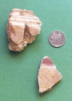
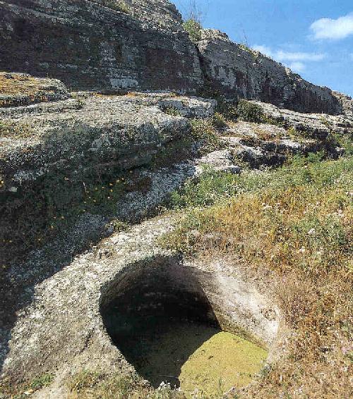
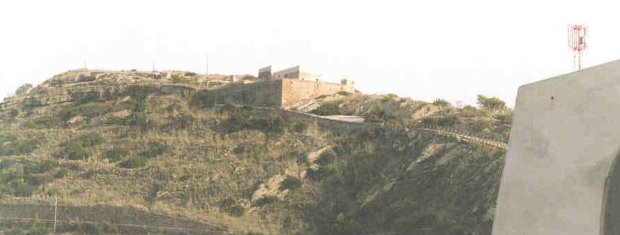
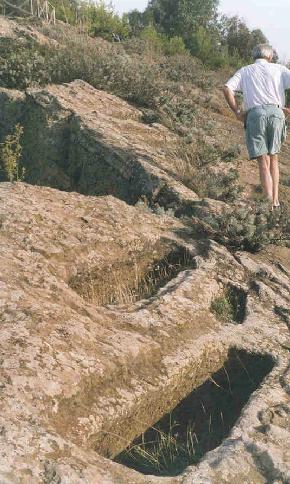
| Falconiera is one of the most prominent vistas in Ustica. It is exactly for this reason that this site has been inhabited since Roman times and probably earlier. The high elevation gave a great overview of most of the island which allowed an early warning if hostile forces were planning an attack. Today the site has been developed for tourism. There are well marked paths and informational signs in Italian. The peak is the site of a Roman habitation. These are not the ruins of elaborate temples but rather those of simple dwellings of an average Roman village. Most of the details have been lost to time and are not readily evident without a descriptive guide. Further down the mountainside towards the town are two Bourbon fortresses built in the 1760's to protect the group of colonists sent by the king in order to form a permanent inhabitation on the island. These colonists were the forefathers of the current population. A little further down from the fortresses lies the necropolis, an ancient area used for burial. Most evident are about 150 tombs carved directly into the surface of mountain. There are also some large crypts which contain the same carved tombs and some wall vaults with evidence of use by early Christians.. | 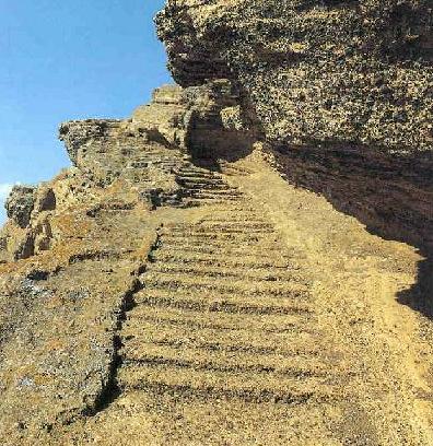
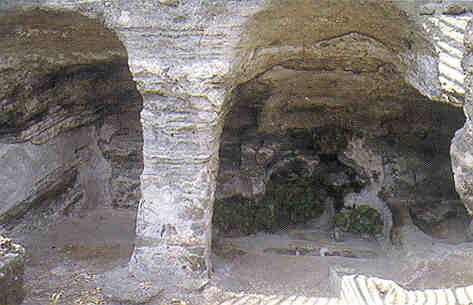
These stairways carved into the mountain connected the tiers of homes on either side of the mountain. It's very steep and windswept here and tourists are not allowed on the path. |
 |
|
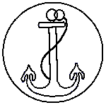
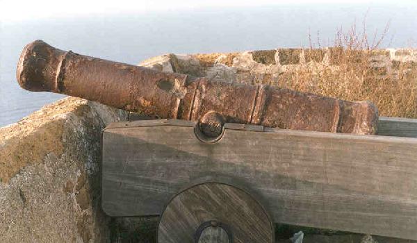
| The last remaining cannon at the upper Bourbon fortress.
Imprinted in the hinge is the date 1780 and on the top a maritime
Bourbon seal.
|
 |
 |
|
[Panorama] [Welcome] [Map] [Faraglioni] [Falconiera] [Culunnedda] [Baseball Field] [Santa Maria Tower] [The City] [Spalmatore] [The Grottos] [The Old Town] [The Cemetery] [The Back Dock] [Tramontana] [Pass of the Madonna] [Chapel of San Bartolicchio] [Geology of Ustica] [Plan a Trip]