Faraglioni
| Chris Caravella's Virtual
Tour of Ustica
Faraglioni |
|
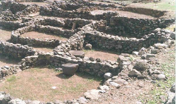
| Faraglioni is an impressive bronze-age archeologic
site which is dated from about 1450 B.C. It is currently being developed
as a tourist destination. The site was once a large and prosperous
city well positioned on the trading routes of the Tyrrhenean sea.
Evidence suggests that it was abandoned rather quickly leaving behind many
intact artifacts which are housed in the museum at the Santa Maria Tower.
As much as 60% of the site has collapsed into the sea as the island has
eroded around the neck of dormant volcano that constitues Ustica.
|
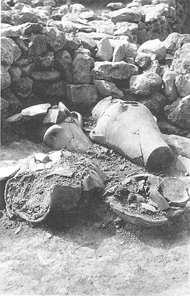
Large jugs as they appeared during the late 1970's excavations. These are now kept in the museum at the Santa Maria Tower. |
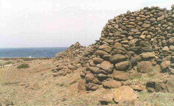
The outer walls of the city. The large mounds in the walls served as turrets and are evenly spaced along the perimeter. The massive size of some of the boulders is a testament to the skill and ingenuity of the builders of the city. |
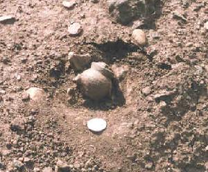
A small jar that I found while at the site (coin for scale). There is still a wealth of artifacts uncovered at the site. Pottery shards litter the paths. This jar will be housed at the museum. Way cool! |
| An abicus bead (?) and pottery shards found at Faraglioni. The lowermost pottery shard has holes bored into it for a cord to act as a handle or to secure a lid. | 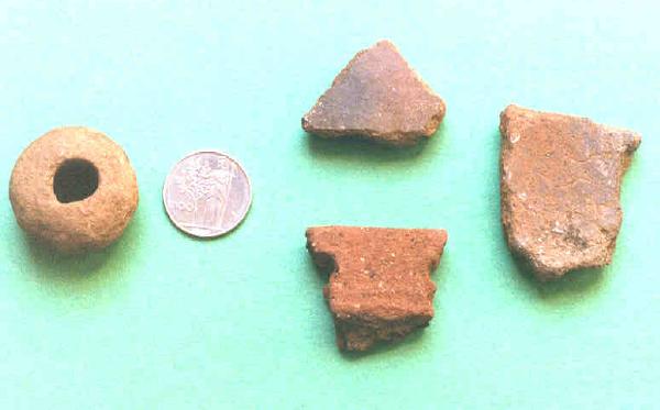 |
[Panorama] [Welcome] [Map] [Faraglioni] [Falconiera] [Culunnedda] [Baseball Field] [Santa Maria Tower] [The City] [Spalmatore] [The Grottos] [The Old Town] [The Cemetery] [The Back Dock] [Tramontana] [Pass of the Madonna] [Chapel of San Bartolicchio] [Geology of Ustica] [Plan a Trip]